
")
In several cities (Golfe Juan, Cannes, Grasse) you will see "Route Napoléon" signs. Here is the explanation and, for those who are interested, the location of the last part of the original intinerary which still is in the same condition as when the Emperor used it.
The "Route Napoléon" links the places where Napoleon spent a night on his way back from the Island of Elbe to Grenoble. This is a touristic road, such as the "wine road" in Burgundy or the road of the "Great Alps" (Grandes Alpes). It's not the exact itinerary which Napoléon and his little troop used. They went through simple trails, sometimes in very poor condition and which most of the time don't exist any longer. Of course the N85, the official Napoléon road did not exist then.
This road starts in Golfe Juan (Vallauris) where the troop landed on March the 1st, 1815, and ends in Grenoble where Napoléon arrived 7 days later.
There is still one place, one only, where you can walk in the Empereor's footsteps and where nothing has changed since he was there. The pebble pavement of the trail still is the pavement his troop walked on.
A little bit of History
In 1814, Napoléon resigned. He was given the Island of Elbe as a kingdom. Soon, he felt like in a prison. Among the allied countries, several ones were not happy with the situation and several plots to kill him or to restrain his freedom were planned. In total secrecy, Napoléon left Elbe to seize back his throne in Paris. That's an exceptionnal coup. He was going to chase Louis XVIII from power, forcing him to leave the country without firing a single shot. His famous address to his men : "The Eagle will fly from church tower to church tower until the towers of Notre Dame" gave its name to this epic : the "Flight of the Eagle".
Much sooner, Bonaparte, then First Consul had planned the creation of a road between Grasse and Sisteron. But the orders had never been executed and for most of the trip, the troop walked in very adverse conditions, using snow and mud covered passes more than 1000m high. Napoléon had chosen this itinerary in Grasse despite this problem to avoid the many royalist troops and supporters in Marseille.
If you read French you can read this article written by Jacques L'AZOU. Or this book with maps : L'Ile d'Elbe et le Retour de Napoleon.
Then it will be the "Cent jours" (Hundred days) and a new war and Waterloo, and the last exile in Ste Helen.
Here is a list of the stopping places of the Flight of the Eagle :
- Golfe Juan : landing on March the 1st, 1815
- Cannes : camp the 2nd in the morning on the present location of the rue des Belges
- Grasse
- St Vallier de Thiey
- Escragnoles where he spent the evening
- Séranon where he stayed for the night. Beyond, the itinerary leaves the Maritime Alps.
- Castellane
- Barrême
- Le Chaudon
- Digne
- Malijai
- Sisteron and its citadel, the main point which could have stopped Napoleon.
- Gap
- Corps
- La Mure
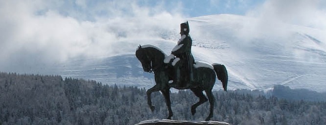
- Laffrey
That's where he confronts the troops sent by the king of France, in a famous "meeting". Napoléon orders that his soldiers leave their weapons. He walks alone towards the soldiers of the King, many of them veterans of the Great Army. Their captain orders them to shoot him. Napoléon opens his famous grey gabardine : "if one of you wants to kill his Emperor, here I am." The soldiers run toward him, cheering and shouting "Vive l'Empereur" (long life to the Emperor). The captain flees on his horse. The road to Paris is open. - Vizille
- Grenoble, on March the 7th.
- Prev
- Next >>